Snooper decided to pack up on our last trip so had to revert back to the old map book to find our way to the site. Sent it to Snooper for repair £75 and still not fixed then sent back again to be told it will be £137-00 to fix, when I can buy a new sat nav for £60-00 so I would not recommend Snooper.
Anyone else had problems ??
We use maps (oh how old fashioned!) and directions on Google Maps (free with the phone). The Škoda sat nav can’t find its satellites now and thinks we’re in the North Sea - we keep moving east. Exciting!
Quote: Originally posted by Fiona W on 23/2/2022
We use maps (oh how old fashioned!) and directions on Google Maps (free with the phone). The Škoda sat nav can’t find its satellites now and thinks we’re in the North Sea - we keep moving east. Exciting!
Maps don't break down or lose contact with satellites, which is why I still use them too. I drove for 53 years using only maps, they still work as they always did. I sometimes set my sat-nav up when I'm a few miles from my destination if I've never been there before, but I mainly use it as a back-up to my research of the route.
I am the same when sailing. When I did my Yachtmaster theory training, it wasn't that long ago but we were always taught that GPS should be regarded as an aid to navigation and not as a sole means of navigation. I still use charts, compass, tide tables and dead reckoning. I can use a sextant but rarely sail far enough or for long enough to use it. I use GPS to give a precise lat and long position if I need to.
i cover 1000 miles a week, from carnforth down to bangor, and across to hebden bridge.
20 plus stops per night, in and out of housing estates, up farm tracks, everywhere
satnav straight to the doorstep. i probably have a problem with 2 in a hundred deliveries, and they are normally caused by temporary road closures. i just block the road and reroute.
Quote: Originally posted by gedsjeep on 24/2/2022
i cover 1000 miles a week, from carnforth down to bangor, and across to hebden bridge.
20 plus stops per night, in and out of housing estates, up farm tracks, everywhere
satnav straight to the doorstep.
technology has moved on people....
No need to lecture us “people” - we do use the technology.
It’s been said in the thread that Sat nav is good for getting to the door. And you’d need lots of maps for your job.
But sorry, I don’t go hill walking with Google maps. We all need the right tool for the right job and Sat nav is the right tool for you. I like maps for many reasons, not just for getting from A to B.
My Army dad taught me to read them.
I'm inclined to agree with Fiona W. You are working Gedsjeep, and your job would be made a lot easier by a sat-nav. When I'm driving these days it is generally to somewhere I know well except when I am on holiday. Even then, thanks to many years of being on the road as a coach driver then as a service engineer, I can usually find most places without much difficulty except for maybe the last few miles to my ultimate destination, and time isn't usually critical either as it would be for you.
When I was working as a service engineer my boss didn't provide me with a sat-nav, and I wasn't going to spend my money on one so I just used to print off a detailed map of the last few miles from Streetmap and take that with me along with my road atlas. From Hertfordshire I could be sent to Scarborough one day and Plymouth the next, so I got around a bit. Quite a bit of my work was in East Anglia though and I know that like the back of my hand.
for the OP. rather than lay out on another sat nav, if you have a smart phone consider looking for a suitable app. i use waze alongside the company device.
it shows all the speed cameras, displays hazards such as pot holes, obstructions and even alerts you to vehicles stopped on the hard shoulder. over the runcorn bridge the other night it warned me of an obstruction in the road. 400 yards later there was a branch laying across lane 1. it tells you the speed limit of the road you are currently on, and alerts you to any up coming speed limit changes. as it relies on community alerts it is up to date within minutes and is free. you never pay for an update. it displays road closures due to roadworks or accidents and advises of alternative routes. you can link it to your chosen music streaming service for hands free listening to your favourite music, podcasts or even read you a book as you are driving along. if you input the fuel and cost along with the mpg of the vehicle it can even work out the most cost effective route. it will inform you of any tolls on your route and offer a link to the toll collection website to enable you pay electronically.
and it uses google maps source code so it`s accurate.
Quote: Originally posted by gedsjeep on 24/2/2022
i cover 1000 miles a week, from carnforth down to bangor, and across to hebden bridge.
20 plus stops per night, in and out of housing estates, up farm tracks, everywhere
satnav straight to the doorstep. i probably have a problem with 2 in a hundred deliveries, and they are normally caused by temporary road closures. i just block the road and reroute.
technology has moved on people....
Totally correct.....except when this marvelous and progressive technology decides to go wrong.
Imagine driving on the inner ring road in Paris, as we were with caravan, when the wonderful moved-on technology blithely informed us that we were now approaching the Volkswagen factory in Wolfsburg in Germany.
Luckily we had some old fashioned maps which got us out of the mess.
Satnavs are great advisory tools but only a total optimist would completely rely on them.
Thanks gedsjeep. I’ll check out waze, hadn’t heard of it.
Google Maps is usually enough for our city centre stuff, when a 1:50,000 map isn’t detailed enough, but your app might give me more confidence for Smart M-ways when we go south.
Where I’ve been let down with the car Sat nav, strangely, was in a part of Glasgow where the tall tenements on either side of the road blocked the signal for a crucial few minutes, so we missed a junction & had to turn back.
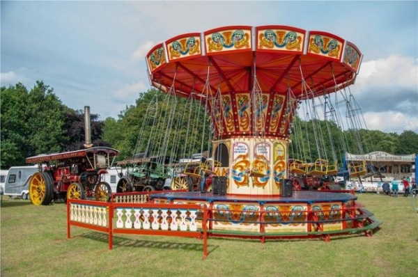
Amazing family weekend with old steam engines, classic car displays, market stalls, and full catering and bar. And camping on site - Save £25 by booking in advance.


 via mobile 23/2/2022 at 8:06pm