Yet another question concerning our first trek to France. We've been looking at routes to our campsites, using different route planners on the internet but the routes all seem to be different. Which do you use and which is the best one for a novice in France to use??
Don't forget to leave a review of the French and other European campsites you have visited!
we use mappy online or via michelin to get an idea of the route and distance , then i get my trusty michelin atlas out and fine tune the route , get all my road numbers, towns etc we are heading for and put it onto the PC then print it off and put it on a clipboard for use in the car if we hit problems.worked near perfect for our 1st visit last year.
Hubby just looks at the map and works it out as far as I can see. I can`t tell right from left on a map, so I drive and he yells.
One thing about French roadsigns that you may find of use...the directions give the next big town along, not the next village/town. So you can end up heading for Paris when you really just want the next village. You need to keep an eye on the map...often the next big town can be hundreds of km away.
And "Toutes Directions" means "Everything except the sign you just passed."
Ah! unfortunately my navigator is as good as you Val when it comes to directions on a map, thats why i'm after the simplest version of a route planner possible. It's our first time driving in France and I'd rather not have to drive and navigate at the same time.
Don't forget to leave a review of the French and other European campsites you have visited!
Viamichelin is good - as is Mappy.com. You can 'fine tune' both routes, that is select 'non-autoroute', etc. I think both give you an option of car/caravan, which makes sure the route you have chosen is suitable for caravans. A good idea is to print off the map, then copy it onto 'Post its' and stick them on your dash, or steering wheel, so that whenever you take a junction, you peel off that post-it and there's your next leg.
I think the AA do a good route planner if you're a member - we had a cracker from them a few years ago, with every last signpost mentioned. Don't know if they still do it.
Where are you heading, and have you made any draft route plans yet? Maybe the old hands amongst us can give you some tips.
Quote: Originally posted by Tosker on 26/04/2005
Ah! unfortunately my navigator is as good as you Val when it comes to directions on a map, thats why i'm after the simplest version of a route planner possible. It's our first time driving in France and I'd rather not have to drive and navigate at the same time.
i know what you mean mate..
i got the kids to read out the next town or road number then put a pen line through it when we`d past it.very helpful and it gave them something to occupy their minds as well on the long journey plus it was quite educational for them.
toutes directions on the signpost is very useful , just follow that if you get stuck,you usually pick up where you want to be from that.
as has been said already , its usually the next major city signposted , ie when in Orleans i followed the signs for clermont ferrand , 300 miles south of our location !!
We used the AA route planner last year which was extremely accurate and easy to follow. The only thing they got massively wrong was the journey time. We went flat out along the route they said should take 8 hours. It took us 12!!! Apart from that though, the directions were great.
------------- Pixie
Don't forget to leave a review of the French and other European campsites you have visited!
Ah! unfortunately my navigator is as good as you Val when it comes to directions on a map, thats why i'm after the simplest version of a route planner possible. It's our first time driving in France and I'd rather not have to drive and navigate at the same time.
Get her to drive? That`s what we do.
And from what I recall, the route from St Malo to La Vieux Chene wasn`t long or complicated. Head for Dol-de-Bretagne, dodge round or go through (not a big town) and there you are. We got off the ferry at about eight am and headed straight there to see if we could dump the trailer tent. Of course at that time of year they weren`t busy so let us straight on (we could choose our pitch from several free ones) and we were set up and in the pool by lunchtime.
ViaMichelin is our first choice. It gives a detailed route you can print off and take with you, and it includes speed camera locations in the itinerary. You can put in towns you want to go via as well, so you can select different routes round Paris for example. When we went south, we looked at Calais to Perpignan via Limoges, via Clermont Ferrand, and even via Bordeaux. We used that one coming back due to snow in central France!!
I use Microsoft Autoroute for initial planning and while on route I use the Michelin map book - I can read maps and am a MUCH better navigator than my OH, whose sense of direction leaves a lot to be desired.....
I want to emphasise whatever mode you use, write a list of the major towns at the end of the road you are using, even if you do not intend to go that far. We had a picturesque and unexpected visit to the centre of Nantes (after midnight) just because I was looking for La Roche sur Yon not Bordeaux.
It's just annoying and each time you make a mistake you learn from it - guarentee we won't do that again this year....... Mainly because we're heading for St Nazaire first and I know that we will be looking for either St Nazair or La Baule .... I think! lol
------------- Some days are diamonds.......
Don't forget to leave a review of the French and other European campsites you have visited!
Bet you can't find the bridge in St Nazair first time :D
Guys - If your navigator isn't that good, I would suggest you save up and buy a tom tom go. Perfect directions every time, you can set it up to talk to you in a nice female voice, it doesn't nag when you miss a turn, it never suggests you stop and ask for directions and when you get fed up listening to it you can turn the volume off. If it could cook I would leave the wife at home this year
Bought myself a Navman iCN 610 about a month ago,and once you fine tune it for the various type of road you wish to use,it's brilliant.
However.........
To get the various European country maps,you have to get an unlock code from Navman for the CD's that are supplied,and it can cost about £80,plus you will need a MMC/SD card of,say,512 to house the UK and the 1 selected 'Region' that you have unlocked.
Far better off getting the Navman iCN 510,which comes with the European maps included.It costs more,but when you total it all up,probably no more than the 610.
But in saying all that,it'll be better than having my missus read a map,as she gets lost at the end of the drive.
Just though i'd throw my two pennywoth in! have just come back from caravaning in Germany and used Tom Tom 3 sat nav on my PDA, it worked a treat ! .We are off to France in july and will be using same to get to Canet-plage although will be taking michellin based map just in case.Would recommend this software too anyone who's interested.
Quote: Originally posted by Pennine Plodder on 02/05/2005
What's the problem with the St Nazaire Bridge? - Will it not be signposted Pornic or Noirmoutier or even Sables
As you approach St Nazaire heading East, you see a hugh massive bridge to your left. You can see if from miles away. It took us two hours to find the road to the bridge - I thoought it was just us, but I know three others who have had the same problem. Haven't been there since 1998, so they may have fixed the signposts now
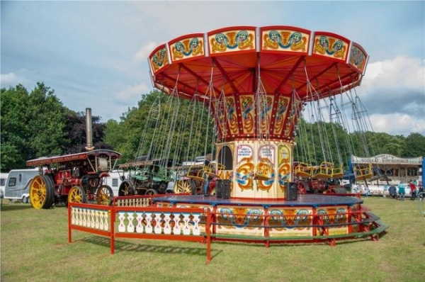
Amazing family weekend with old steam engines, classic car displays, market stalls, and full catering and bar. And camping on site - Save £25 by booking in advance.